Drone Photogrammetry & 3D Modeling
SkyBlue Aerials provides professional drone photogrammetry services that turn overhead imagery into accurate, measurable site deliverables. We help construction, land development, and asset teams visualize sites clearly, track changes over time, and make better decisions with deliverables that are easy to share and ready for real-world workflows.
We serve Palm Beach, Broward, Martin, and St. Lucie counties, with fast turnaround and repeat flight scheduling for ongoing progress documentation.
RTK-enabled drone mapping delivering site-accurate, construction-ready deliverables for planning, documentation, and quantity reporting.
✳︎
New Construction
✳︎
RTK-enabled drone mapping delivering site-accurate, construction-ready deliverables for planning, documentation, and quantity reporting. ✳︎ New Construction ✳︎
What is Photogrammetry?
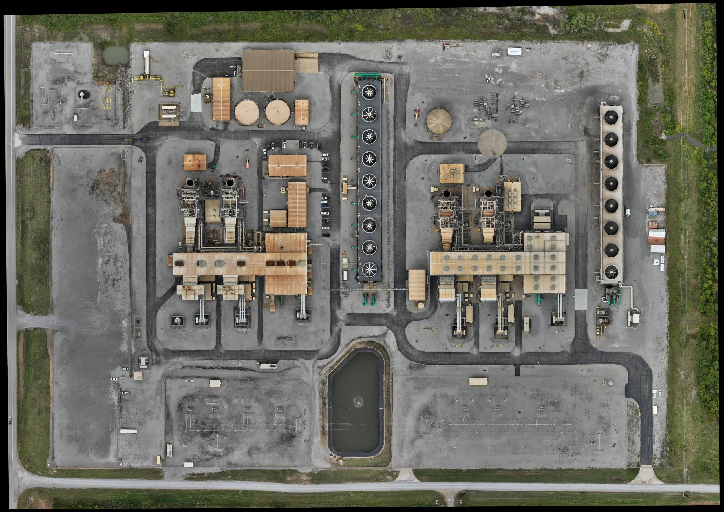
Photogrammetry is the process of capturing overlapping aerial images and stitching them into a high-resolution map and 3D model. Instead of just seeing a site, you gain a measurable view that supports planning, coordination, and documentation.
Turnaround Time
Most deliverables are provided within 48–72 hours after the flight (rush options available). Recurring progress flights can be scheduled weekly, bi-weekly, or monthly.
What You Receive
Depending on your project scope, photogrammetry deliverables may include:
Orthomosaic Map (Ortho): A stitched, top-down map that’s easy to measure and share
3D Model: A realistic 3D view of the site for planning and communication
DSM / Surface Model: A surface elevation layer for analysis and reporting
Contours: Useful for grading visibility and topographic reference
Volumetrics: Stockpile volume measurements and quantity summaries
Progress Mapping: Repeat maps that show change over time
How Pricing Works
Pricing is based on site size, deliverables requested, and flight frequency. If you need ongoing progress mapping, monthly programs offer predictable pricing and consistent reporting.
Call to Action
Ready to get a map or 3D model of your site?
Send your site address, approximate acreage, and timeline—we’ll reply with a recommended scope and a fast quote.
Common Use Cases
Photogrammetry is commonly used for:
Construction site documentation and progress tracking
Earthwork planning, coordination, and reporting
Stockpile volume tracking and material validation
Pre-construction site baselines and existing conditions
Stakeholder updates for owners, lenders, and remote teams
Visual planning for site logistics and access routes
Service Area
SkyBlue Aerials supports projects across Palm Beach County, Broward County, Martin County, and St. Lucie County (and surrounding areas).
FAQ block
Do I need ground control points (GCPs)?
It depends on your accuracy requirements. For most documentation and planning, standard mapping is sufficient. For tighter tolerances, we can discuss control options.
Can you align maps with design files?
Yes—if you provide CAD/site plans, we can help create clean overlays for coordination.
What formats do you deliver?
We deliver in common mapping and sharing formats depending on your workflow.
2025
We produce high-resolution orthomosaics, 3D models, DSM surfaces, contours, and volumetrics using RTK positioning for consistent alignment and repeatable progress tracking.
Get In Touch
If you're interested in working with us, complete the form with a few details about your project. We'll review your message and get back to you within 48 hours.