FAQs
Do you provide CAD overlays or as-built alignment? Yes—if you provide CAD/design files, we can align them to your current orthomosaic for a clean review map.
Can you provide outputs my team can open easily? Yes. We deliver common formats like PDF, CSV, and industry-standard mapping outputs on request.
How often should we fly progress maps? Most projects do weekly, bi-weekly, or monthly depending on schedule and stakeholder reporting needs.
Construction Drone Mapping in Palm Beach County
SkyBlue Aerials provides site-accurate drone mapping for construction teams across Palm Beach County. We deliver clear, contractor-ready outputs—orthomosaics, surface models, contours, and quantity reporting—so PMs, supers, and earthwork teams can make faster decisions, verify progress, and reduce rework.
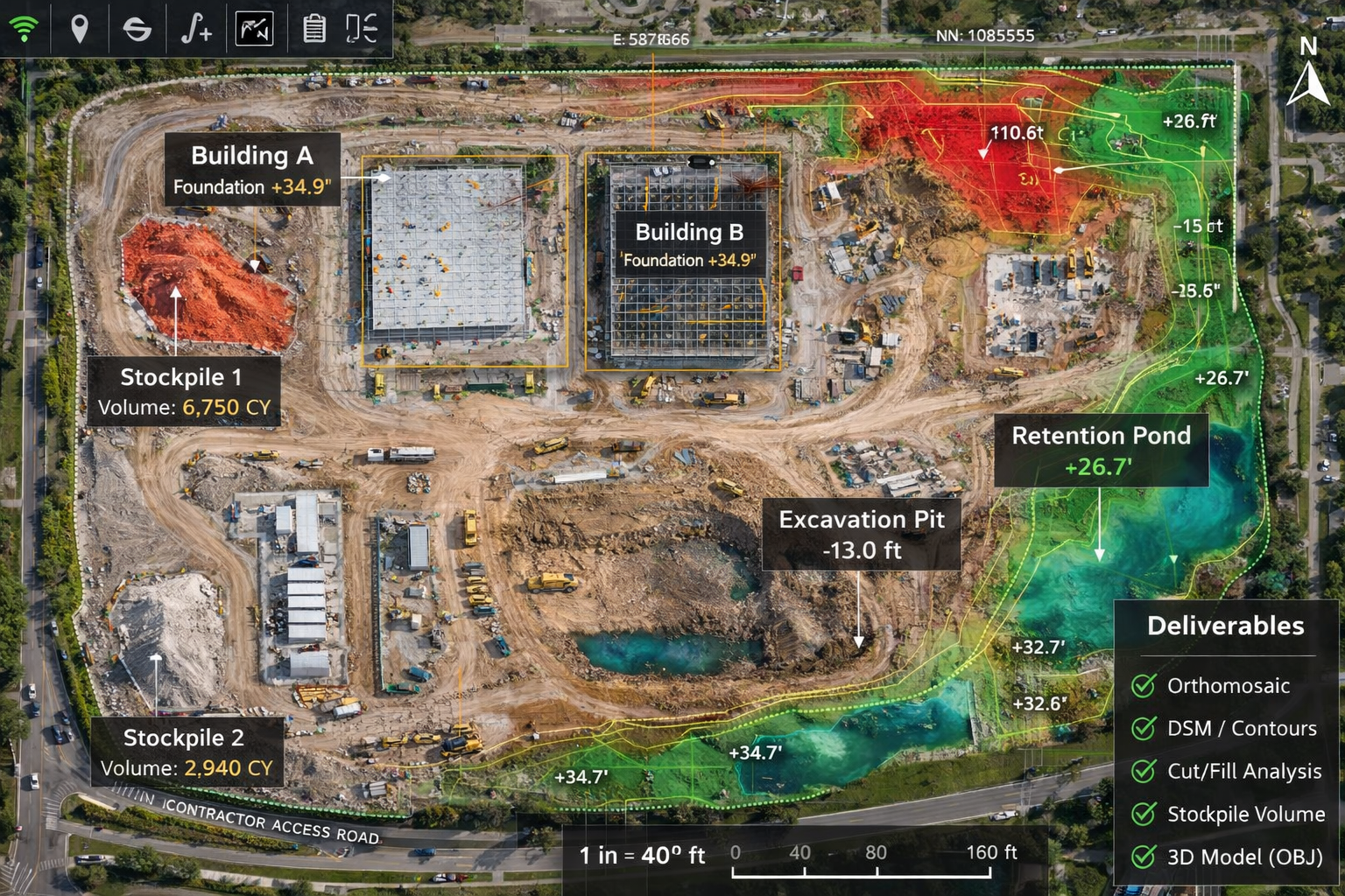
Section: What You Receive (Deliverables)
Our construction mapping deliverables are designed for field use and office coordination. Depending on scope, your deliverables can include: Orthomosaic (Ortho) for site documentation, DSM for surface analysis, Contours for grading visibility, optional Cut/Fill reporting, Stockpile volumes, packaged 3D assets, and a Control/QA summary when required.
Typical Use Cases
Progress documentation and stakeholder updates
Quantity verification for stockpiles and earthwork movement
Pre-pour/pre-grade checks and coordination support
Site planning visuals for subs and owners
Change tracking and reporting over time
Turnaround Time
Standard delivery is 48–72 hours after flight (rush options available). Repeat progress flights can be scheduled weekly, bi-weekly, or monthly.
How Pricing Works
Pricing is typically based on site size, required deliverables, and flight frequency. Travel and setup are itemized for transparency. For recurring sites, we offer structured progress options with predictable monthly pricing.