Farm Field Mapping & Management Zones (Row Crops)
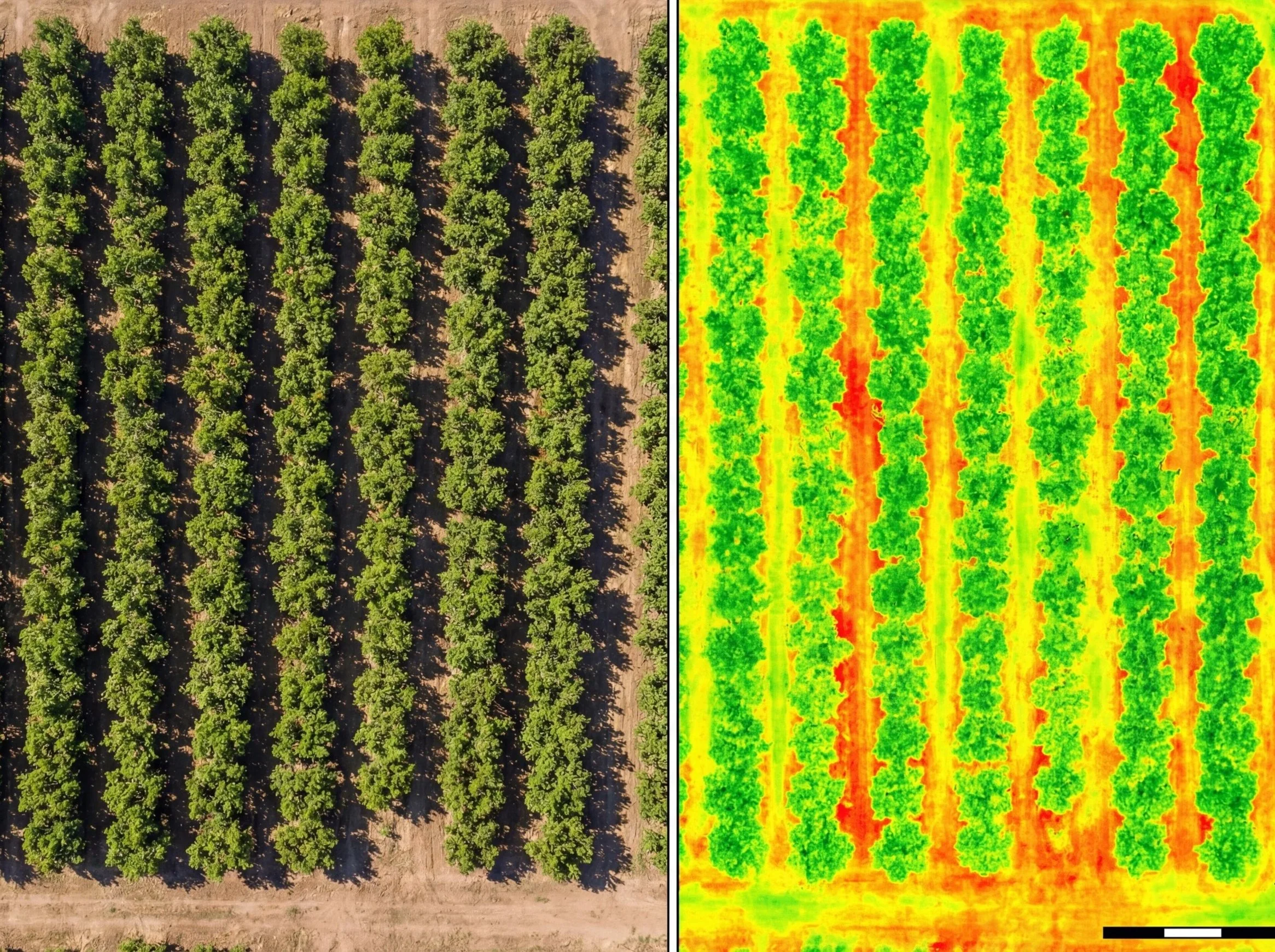
For row-crop operations, speed matters. SkyBlue Aerials delivers drone mapping that turns field variability into clear, actionable direction. We help growers identify patterns that commonly point to irrigation issues, nutrient variability, emerging pest/disease pressure, or uneven stand establishment—so you can react earlier and avoid broad, expensive guesswork.
Our mapping is designed to support practical decision-making. You’ll receive clear field-level map outputs and an easy-to-follow summary that points your team to the areas that need ground truthing first. When needed, we can also structure the results into management-style zone views that separate stronger vs weaker performance areas to guide targeted follow-up and seasonal planning.
We serve farm operations across Palm Beach, Broward, Martin, and St. Lucie counties, and we can support one-time “checkup” flights or recurring monitoring throughout the growing season.
Turnaround: Typically 48–72 hours after flight.
Pricing: Based on acreage, field complexity, and monitoring frequency.
Our Approach
What began as a passion has evolved into something more. We’re proud of where we’ve been and even more excited for what’s ahead. What sets us apart isn’t just our process—it’s the intention behind it. We take time to understand, explore, and create with purpose at every turn.
Simple ideas
Through every step, we've focused on staying true to our values and making space for thoughtful, lasting work.
Lasting impact
We build with clarity, act with integrity, and always stay true.